How Can We Help?
Coordinate Reference System
Once you’ve added vector data to your QGIS project you need to re-project, clip and edit it, ready to import into UE4 using TerraForm, but the first thing to do is to make sure it’s in the correct coordinate reference system. We’ve already exported our DTM, which is in the CRS we want for the project. This tutorial follows on from Finding Source Data > Open Street Map (Vector Data), so we’re starting this guide using the data we downloaded using Quick OSM for QGIS.
LOAD DTM DATA
Step 1
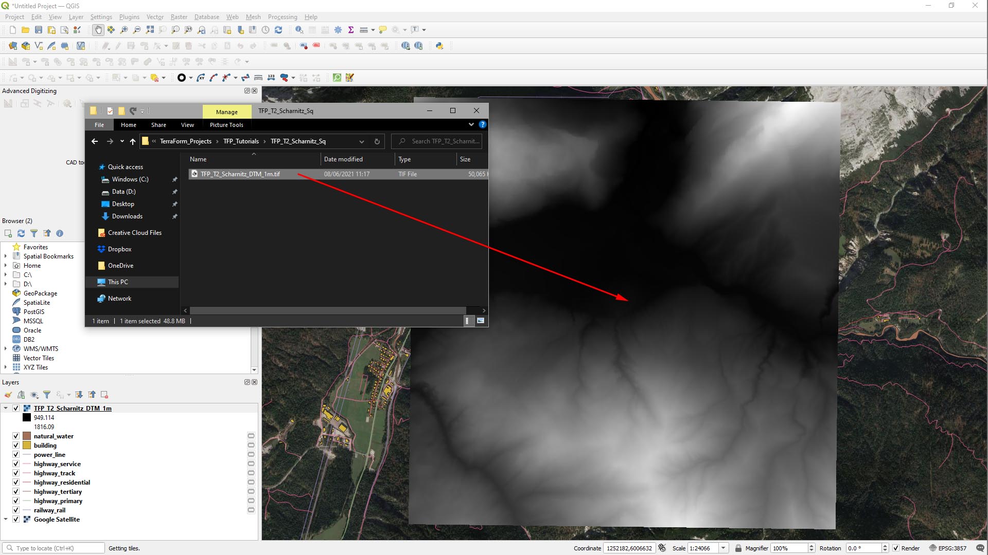
The first thing we need to do is to add our DTM data to the QGIS project. Ours is downloaded from the Austrian government’s data portal: https://www.data.gv.at/. We then went through the steps for Preparing DTM (Terrain) Data.
- Drag the DTM GeoTiff file into your QGIS project viewport.
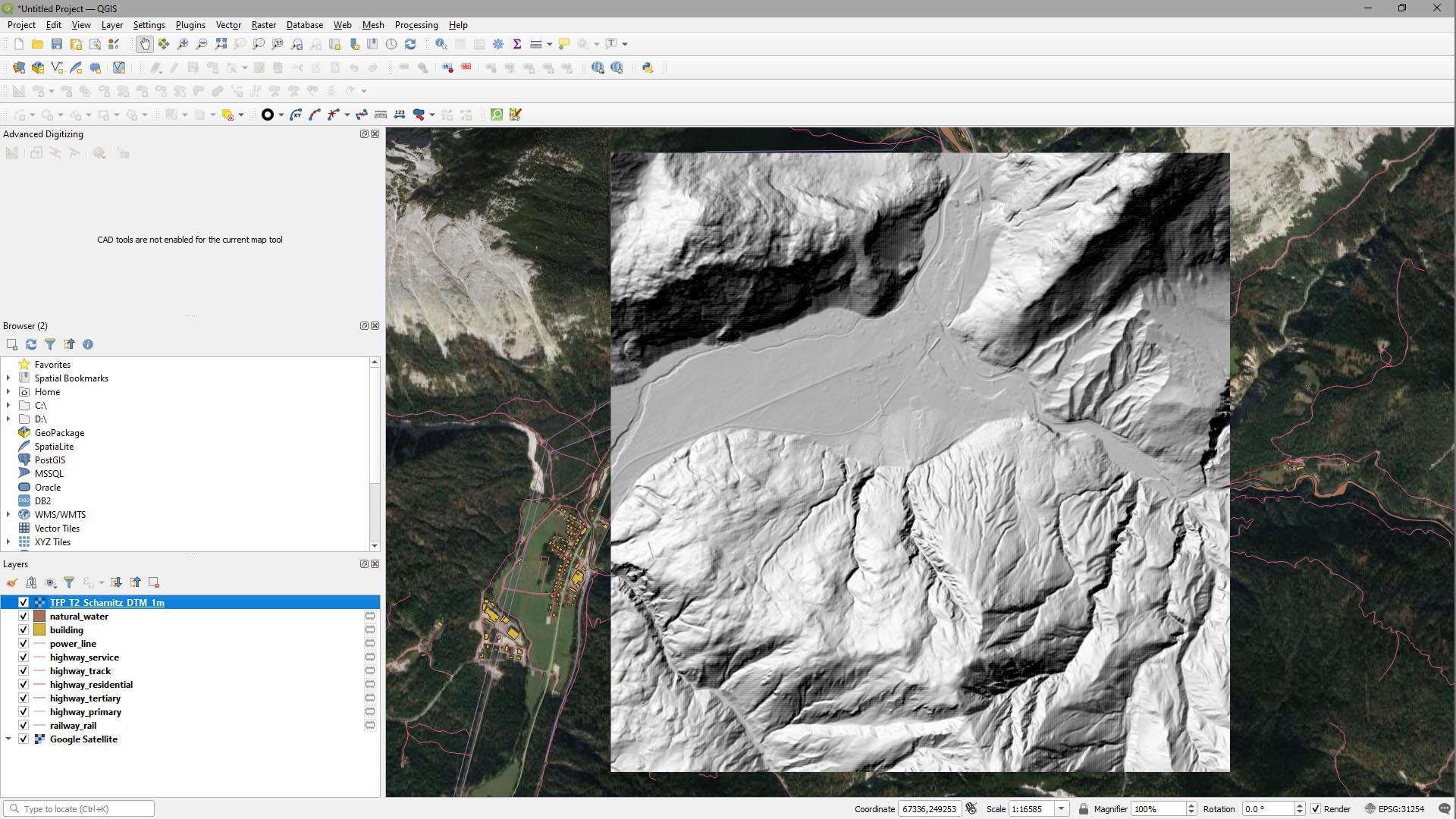
It’ll look like this.
Step 2
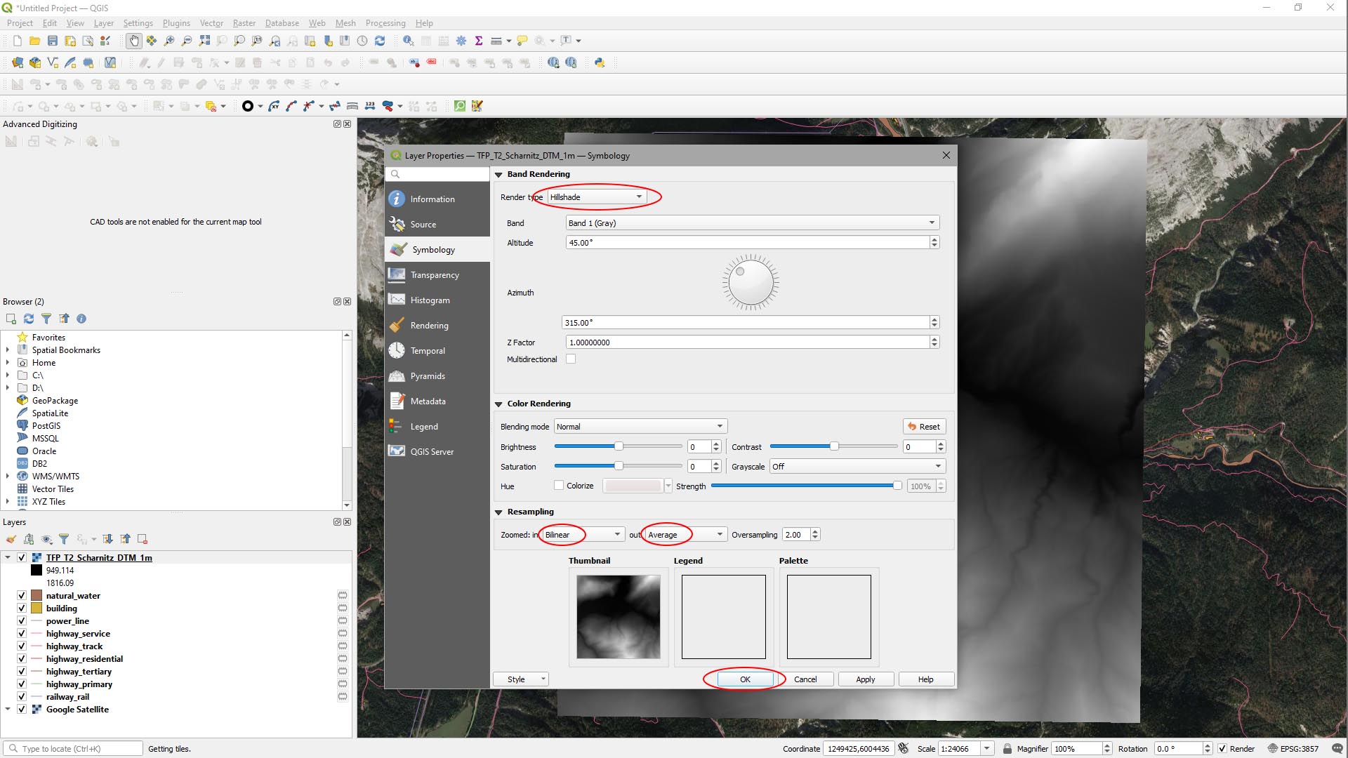
We can make the DTM data look a little more useful by changing the shader:
- Right-click on the DTM layer in the Layers panel and select Properties…
- Change Render Type to Hillshade.
- In Resampling set Zoomed: in to Bilinear and Zoomed: out to Average.
- Hit OK.
SET COORDINATE REFERENCE SYSTEM
It’s obvious that the DTM data is slightly rotated. That’s because our DTM data is in a planar projection, but the project is in a round Earth projection. We need to set the project to use the planar projection of the coordinate reference system of the DTM data.
- Right click on the DTM data.
- Click Set CRS.
- Select Set Project CRS from Layer.
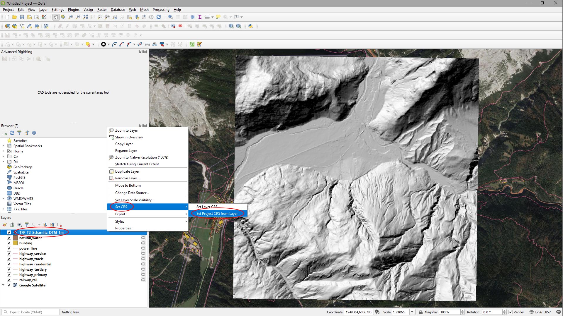
Now the project CRS is set to the DTM’s projection, it’s no longer rotated and looks like this: